Experience Pro-Grade Precision with GNSS Solutions Drone GPS — Buy Now

The heavens now differ. Today, unmanned aerial vehicles provide cinematic images, land survey, infrastructure inspection, and more, not only birds or clouds swooping overhead. But one factor determines all of that performance: GPS accuracy. You are flying blind if you are still flying using normal technology. It’s time you used the drone GPS of GNSS Solutions to experience the future of flight navigation.
Why “Good Enough” GPS Just Won’t Cut It Anymore
Whether your job is running a fleet for agricultural mapping, as a land surveyor, or being a professional drone pilot, you are aware of the very narrow margin for error. Standard GPS often wanders several meters, a discrepancy that might ruin data sets, video, or even cause collisions.
Here is when drone GPS from GNSS Solutions becomes really crucial. This is not your daily navigation. Under the most taxing airborne operations, it is constructed for dependability, stability, and accuracy.
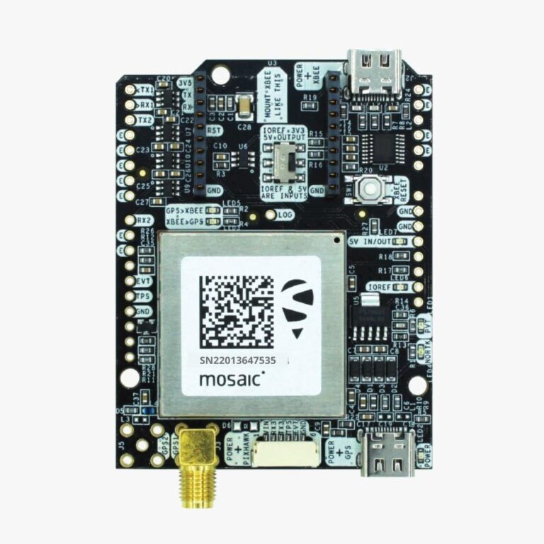
GNSS Solutions’ Next-Gen GPS Modules
Engineer drone GPS modules at GNSS Solutions that command accuracy rather than merely follow satellites. Your drone navigates with surgical clarity using RTK (Real-Time Kinematic) support, multi-band capabilities, and lightning-fast satellite acquisition.
For the hobby community, they are not mass-produced modules. They are built for integration into corporate drone systems, tough, professional-grade tools.
5 Real-World Reasons Professionals Rely on GNSS Drone GPS
- Centimeter-Level Precision: Forget “close enough.” With multi-constellation GNSS tracking, our modules nail your drone’s location within a centimeter. It’s the kind of accuracy land surveyors and 3D mapping professionals dream about.
- Unmatched Signal Stability: Weak GPS signal? Urban canyons? Remote wilderness? Our modules lock onto multiple satellite systems (GPS, GLONASS, Galileo, BeiDou) to keep your drone on track no matter the environment.
- Plug-and-Fly Integration: Designed for flexibility, GNSS Solutions’ systems offer seamless integration into major drone platforms like Pixhawk and ArduPilot.
- Low-Latency RTK Corrections: For missions requiring real-time accuracy, our RTK modules reduce latency and boost real-world usability without expensive base station requirements.
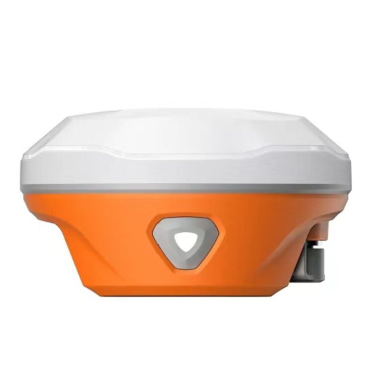
- Industrial Durability: Engineered for fieldwork, our GPS units resist vibration, moisture, and shock. Reliability isn’t a feature—it’s a promise.
The Professional Advantage: Our GPS Performance Compared to the Market
While other companies promote devices suitable for weekend fighters, GNSS Solutions pushes limits. Our customers work in precision-critical sectors, where a few centimeters might translate into thousands of dollars.
Already assisting is our drone GPS:
- Movie teams record regular aerial sequences.
- Agronomists maximize the mapping of crop production.
- Engineers track infrastructure with exact placement.
- Real-time generation of sub-centimeter 3D models by surveyors
- When the output is precision, compromise is never a choice.
Reasons You Should Upgrade Right Now
Those looking for “drone GPS” are solving problems, not window shopping. Either you are struggling with data inconsistencies, lost track of your UAV, or are bored with drift. GNSS Solutions answers that now, not someplace.
Here are what results from your investment in our drone GPS:
- Your flying missions become safer.
- Your material starts to be reliable.
- Your process picks up speed.
- Your company strikes a more polished image.
- And indeed, your scores improve.
The Competitive Edge of GNSS Solutions
We are not another IT vendor. We are a GPS performance firm. We back every drone GPS with:
- Specifically tailored customer assistance
- Updates in firmware allow you to remain flying on the newest standards.
- Custom calibration services for original drone constructions
- RTK service alliances are meant to save running costs overall
- GNSS Solutions is more than just technology; it’s a toolkit for aerial supremacy.
Frequently asked questions (FAQ)
Can my DJI drone use the drone GPS from GNSS Solutions?
Custom and professional builds are what our systems are meant for. Although DJI consumer drones have restrictions, we promote open-source solutions for complete control and integration such as ArduPilot and Pixhawk.
2. Installable difficulty
You’re in good shape if you can follow a wiring schematic and plug in a cable. Our detailed install directions simplify setup.
3. Do I need an RTK base station?
Although we also enable NTRIP adjustments via the internet, so allowing more flexibility in the field, you can use our GPS with a base station.
4. Are autonomous drones suited for this GPS module?
Perfect. Designed for autonomous navigation, waypoints, and mission-critical dependability, our highly accurate GPS modules
5. Describe the warranty.
Every GPS device has a 12-month guarantee and lifelong support thanks to our committed tech crew.
Prepared to improve your flight?
If you are looking for the greatest drone GPS, you really need not settle. The only professional-grade system designed to fit your ambition is available from GNSS Solutions.
Click here to review our product line and see how GNSS Solutions is revolutionizing drone navigation in many different sectors.
Visit GNSS Solutions – Precision You Can Trust.