GNSS for Inspection & Patrol Drones
High-accuracy, anti-jamming GNSS enables inspection drones and patrol robots to navigate autonomously along precise corridors, execute repeatable survey paths, and deliver reliable coverage in challenging industrial environments.
Reliable GNSS for Industrial Inspection and Patrol Missions
Inspection drones and patrol robots depend on precise, interference-resistant GNSS to follow repeatable flight paths, maintain safe standoff distances from infrastructure, and return accurate geospatial data with every mission.
Whether inspecting power lines, bridges, pipelines, cell towers, or patrolling industrial perimeters, GNSS-equipped platforms deliver geo-tagged imagery and sensor data that can be directly overlaid on GIS maps for analysis. Eview GNSS receivers provide multi-constellation, multi-frequency positioning with integrated anti-jamming protection for reliable operation near high-voltage infrastructure and industrial RF environments.
RTK and PPK positioning modes ensure that all inspection data is accurately georeferenced — critical for identifying defects, tracking changes over time, and producing legally defensible inspection reports.
Key Capabilities
- RTK and PPK inspection-grade accuracy
- Anti-jamming near high-voltage infrastructure
- Precise waypoint and corridor navigation
- Multi-constellation GNSS resilience
- Geo-tagged data for GIS integration
- Autonomous return-to-base positioning
- Low-latency heading and attitude output
What GNSS Delivers for Inspection and Patrol Platforms
From aerial drone inspection to ground-based security patrol robots
Precise Waypoint Navigation
Pre-programmed inspection routes are flown with centimeter-level repeatability, ensuring consistent coverage between inspection cycles for accurate change detection.
Anti-Jamming Resilience
Multi-element antenna technology and adaptive null steering protect GNSS signal integrity near power lines, transmission towers, and industrial RF emitters.
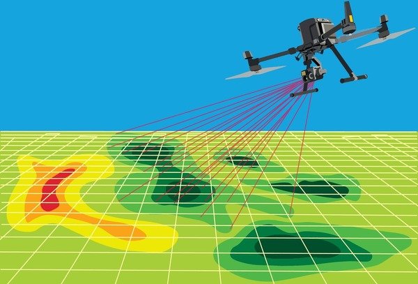
Geo-Tagged Data Output
Every image, sensor reading, and anomaly detected is stamped with precise coordinates, enabling direct overlay on GIS maps and asset management systems.
Corridor Mapping Mode
Linear infrastructure inspection — pipelines, power lines, railways — uses GNSS-defined corridors to ensure complete, overlapping coverage with no gaps.
Autonomous Patrol Routing
Security and perimeter patrol robots follow GNSS-defined patrol paths, logging position and time-stamped sensor data for review and incident correlation.
PPK Post-Processing
Post-processed kinematic positioning provides centimeter accuracy even when RTK corrections are not available during flight, using raw observation data logged onboard.
Inspection and Patrol Applications
GNSS-guided platforms inspect and protect critical infrastructure across every sector
⚡ Power Line Inspection
Drones fly precise corridors along transmission lines, detecting damage, vegetation encroachment, and hardware wear without human line workers.
🛢️ Pipeline Monitoring
Autonomous drones and ground robots patrol pipeline routes, detecting leaks, corrosion, and third-party encroachment with geo-tagged evidence trails.
🌉 Bridge and Structural Inspection
GNSS-positioned drones capture geo-referenced imagery of bridge decks, bearings, and abutments for structural condition assessment and maintenance planning.
📡 Cell Tower and Telecom
Tower inspection drones orbit antenna structures at precise standoff distances, capturing high-resolution imagery without endangering technicians.
🏭 Industrial Facility Patrol
Ground patrol robots follow GNSS-defined perimeter routes around refineries, chemical plants, and logistics hubs, providing 24/7 autonomous security coverage.
🚢 Port and Marine Infrastructure
Drones inspect jetty structures, crane booms, and port perimeters with accurate GPS positioning for complete coverage documentation and asset management.
Frequently Asked Questions
What GNSS accuracy is needed for inspection drones?
Industrial inspection drones typically require RTK or PPK accuracy of ±2–5 cm to produce reliable geo-referenced datasets. This level of accuracy ensures that imagery captured across multiple inspection flights can be accurately co-registered for change detection analysis, and that defect locations can be precisely recorded for maintenance teams. For close-proximity inspection of tower or bridge structures, centimeter-level positioning also helps maintain consistent and safe standoff distances.
Why do inspection drones need anti-jamming GNSS?
Inspection missions frequently operate near sources of electromagnetic interference — power lines, transmission towers, substations, and industrial machinery. These environments can degrade or disrupt standard GNSS signals, causing position errors that may result in unsafe proximity to infrastructure or gaps in inspection coverage. Anti-jamming GNSS receivers use multi-element antenna arrays and adaptive signal processing to maintain reliable positioning integrity even in high-interference environments.
What is the difference between RTK and PPK for drone inspection?
RTK (Real-Time Kinematic) provides centimeter-level positioning in real time by receiving correction data from a base station during the flight. PPK (Post-Processed Kinematic) achieves the same accuracy but applies corrections after the mission by processing raw GNSS observations together with base station data. RTK is preferred for missions where real-time positioning is critical for navigation, while PPK is often used for photogrammetry and mapping missions where data accuracy is more important than live position output.
Can GNSS be used for perimeter security patrol robots?
Yes — ground-based security patrol robots use GNSS to follow pre-programmed patrol routes around facility perimeters. GNSS positioning ensures the robot covers its entire assigned area consistently and can detect deviations from its route. Combined with cameras, thermal sensors, and LiDAR, GNSS-guided patrol robots provide reliable autonomous security coverage for industrial sites, logistics hubs, and critical infrastructure facilities without requiring continuous human oversight.
GNSS for Inspection Drones and Patrol Robots
Multi-frequency, anti-jamming GNSS receivers engineered for demanding industrial inspection and autonomous patrol applications.
Request Technical Specifications