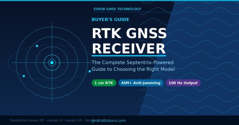
Advancing Surveying Techniques with High-Precision GNSS Receivers

Eview GNSS Technology supplies high-precision GNSS receivers and integrated antennas — all powered by Septentrio chipsets — to professional survey companies, mapping agencies, and construction firms worldwide. This guide covers how RTK GNSS technology is transforming modern surveying, and what to look for when selecting a receiver for professional survey work.
High-precision GNSS receivers have fundamentally changed land surveying. Where traditional total station surveys required line-of-sight between instrument and target, RTK GNSS allows a single surveyor to capture sub-centimetre coordinates continuously across open terrain — and increasingly in challenging environments where previous generations of GNSS technology would fail.
How GNSS Receivers Work in Surveying
A GNSS receiver determines its precise geographic position by measuring the travel time of radio signals from multiple satellites. By processing signals from multiple constellations — GPS, GLONASS, Galileo, BeiDou, QZSS, and NavIC — simultaneously, a modern multi-constellation receiver maintains solution continuity even when individual satellites are obstructed.
For survey-grade accuracy, standalone GNSS positioning (2–5 metres) is insufficient. Survey receivers use RTK (Real-Time Kinematic) correction, which compares observations between a fixed base station and the rover receiver in real time. By cancelling the errors that affect both receivers equally — ionospheric delay, satellite clock drift, orbital error — RTK achieves 1–2 cm horizontal accuracy in the field.
Key Advances in Survey GNSS Technology
Multi-Frequency, Multi-Constellation Tracking
Modern survey receivers track all GNSS constellations on all available frequencies (L1, L2, L5). This matters for three reasons:
- Faster RTK initialisation: Triple-frequency ambiguity resolution achieves fixed solutions in under 10 seconds, vs 5+ minutes for single-frequency — critical when moving quickly between survey points.
- Longer baseline capability: Dual/triple-frequency allows accurate RTK over baselines up to 50–100 km from a reference station, compared to <10 km for single-frequency.
- Better performance in difficult conditions: More satellites tracked simultaneously means the receiver maintains a fixed solution through partial obstructions — tree canopy, building facades, terrain shadow.
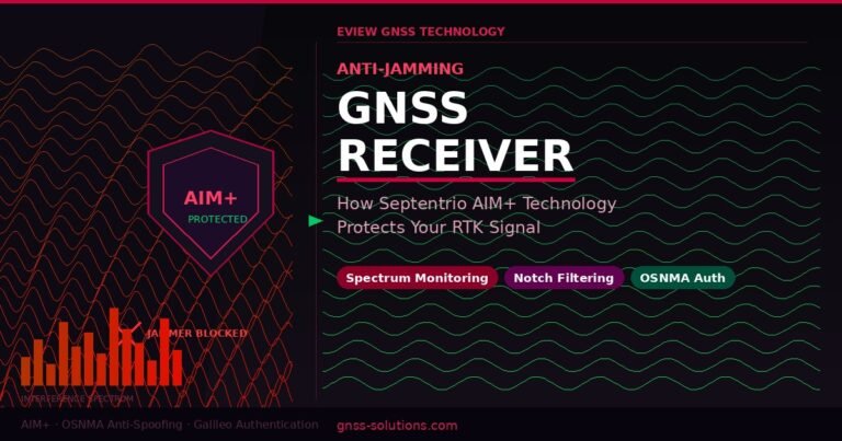
Anti-Jamming and Anti-Spoofing Protection
Survey professionals increasingly operate in environments with unintentional RF interference — industrial sites, urban construction zones, near communications infrastructure. Deliberate jamming and spoofing attacks on GNSS are also a growing concern.
Eview GNSS uses only Septentrio chipsets because they include AIM+ (Advanced Interference Mitigation) — a hardware-level system that detects, notches, and filters RF interference in real time without performance degradation. Septentrio chipsets also support OSNMA (Open Service Navigation Message Authentication) for Galileo signal authentication — the first civilian GNSS spoofing detection at the signal level.
Heading Receivers for Survey Vehicles
When GNSS receivers are mounted on survey vehicles, accurate heading is required to correct for antenna offset from the vehicle’s centre of gravity. The Eview HB52H (powered by Septentrio mosaic-H) uses two antennas to deliver precise heading to ±0.1° at 1 metre baseline — without IMU drift, recalibration, or magnetic interference issues.
RTK GNSS Survey Methods
Static Survey
The receiver remains stationary for an extended period (minutes to hours), collecting GNSS observations that are post-processed to achieve millimetre-level accuracy. Used for geodetic control, benchmark establishment, and structural monitoring.
Rapid Static
A shorter occupation time (5–15 minutes) combined with multi-frequency receivers and precise ephemeris achieves 1–3 cm accuracy. Suitable for control point densification where millimetre precision is not required.
RTK Kinematic Survey
The rover receiver moves continuously while maintaining a real-time correction link to the base station or CORS network. Points are captured at each location within seconds. Used for topographic survey, volume calculations, as-built surveys, and stake-out. Achieves 1–2 cm horizontal with modern multi-frequency receivers.
Network RTK (CORS)
Instead of deploying a local base station, the surveyor connects to a continuously operating reference station (CORS) network via mobile internet. The network models regional atmospheric conditions and provides VRS (Virtual Reference Station) corrections. Eview receivers support all CORS network protocols: MAC, FKP, VRS, and RTCM 3.x MSM.
Eview GNSS Survey Receivers
| Model | Chipset | Channels | Best For | RTK Accuracy |
|---|---|---|---|---|
| HB6 | Septentrio mosaic-X5 | 448 | Vehicle-mount, machine control, rover | 1 cm + 1 ppm H |
| HB6 Pro 4G | Septentrio mosaic-X5 | 448 | Network RTK via integrated 4G LTE | 1 cm + 1 ppm H |
| HB52/HB52H | Septentrio mosaic-H | 448 | Dual-antenna heading, survey vehicles | 1 cm + 1 ppm H, ±0.1° heading |
| HB51 | Septentrio mosaic-X5 | 448 | Compact OEM integration | 1 cm + 1 ppm H |
| RB3 | Septentrio AsteRx M3 Pro+ | 576 | Industrial survey, harsh environments | 1 cm + 1 ppm H |
| HBEV11 | Septentrio mosaic-X5 | 448 | UAV survey, integrated antenna+receiver | 1 cm + 1 ppm H |
Choosing the Right Survey GNSS Receiver
When selecting a GNSS receiver for professional surveying, evaluate these criteria:
- Frequency bands: Triple-frequency (L1/L2/L5) is strongly preferred for fast initialisation, long baselines, and urban performance.
- Constellations: All six (GPS + GLONASS + Galileo + BeiDou + QZSS + NavIC) provides maximum satellite availability and geometric strength.
- Anti-jamming: Hardware-level AIM+ (Septentrio) outperforms software-only approaches in real-world interference conditions.
- Form factor: Box receivers (HB6, HB51, RB3) for vehicle or pole mounting; integrated antenna-receiver units (HBEV11, GR-P3UTR-M4) for UAV and compact applications.
- Data output: Ensure NMEA 0183/2000, RTCM 3.x, and raw RINEX output for post-processing compatibility with your survey software.
Frequently Asked Questions
What accuracy do GNSS receivers achieve in surveying?
Survey-grade RTK GNSS receivers achieve 1–2 cm horizontal accuracy and 2–3 cm vertical accuracy in real time. Static and rapid static surveys achieve millimetre to sub-centimetre accuracy after post-processing. Eview GNSS receivers powered by Septentrio chipsets are rated at 1 cm + 1 ppm horizontal RTK accuracy.
What is the difference between RTK and total station surveying?
A total station measures angles and distances to a prism target with millimetre accuracy but requires line-of-sight. RTK GNSS works anywhere the sky is visible, without line-of-sight, and allows a single operator to capture coordinates at walking speed. For open terrain surveys, RTK GNSS is faster and more cost-effective; total stations remain preferred for structure surveys and high-precision layout in obstructed environments.
What is a CORS network and how does it help surveyors?
A CORS (Continuously Operating Reference Station) network is a regional grid of permanent GNSS base stations that broadcast real-time RTK corrections via internet (NTRIP). Surveyors connect their rover receiver to the CORS network via mobile data and receive corrections without deploying a local base station. This reduces equipment cost and setup time while extending RTK coverage to the entire network area.
Which Eview GNSS receiver is best for land surveying?
For handheld or pole-mounted survey rovers, the HB6 Pro 4G (Septentrio mosaic-X5, integrated 4G LTE for CORS network access) is Eview’s recommended choice. For vehicle-mounted survey and heading applications, the HB52H (dual-antenna, Septentrio mosaic-H) delivers precise position and heading without IMU drift. For UAV survey payloads, the HBEV11 or GR-P3UTR-M4 are the preferred integrated solutions.
Do Eview GNSS survey receivers support post-processing?
Yes. All Eview GNSS receivers log raw GNSS observations in SBF (Septentrio Binary Format) and RINEX formats simultaneously with real-time RTK output. Raw data can be post-processed in any standard survey software (Leica Infinity, Trimble Business Centre, RTKLIB, and others) to achieve millimetre-level static accuracy or PPK kinematic accuracy.