Do Drones Need RTK GNSS? When Standard GPS Isn’t Enough for Professional UAV Operations
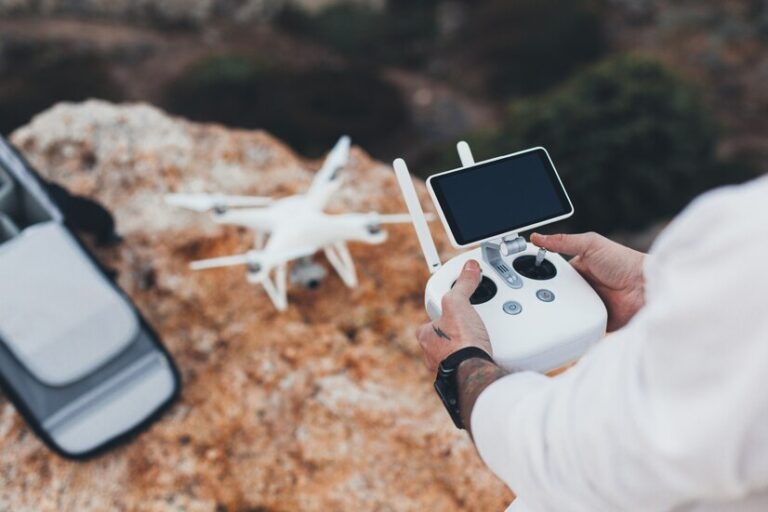
Yes—if your drone needs centimetre-level accuracy for surveying, mapping, inspection, or autonomous operations, you need RTK GNSS. Standard GPS typically delivers 2–5 metre accuracy, which is sufficient for recreational flight but fails for professional applications where precise positioning determines data quality, safety, and regulatory compliance. RTK (Real-Time Kinematic) GNSS corrects atmospheric errors in real time, delivering 1–2 cm accuracy that unlocks the full potential of professional UAV operations.
Standard GPS vs RTK GNSS for Drones
A standard consumer drone GPS receiver uses a single constellation (GPS or GLONASS) and achieves 2–5 metre horizontal accuracy. This works for basic waypoint navigation and stabilisation, but the margin of error becomes unacceptable the moment you need to measure distances, create orthomosaic maps, or fly precise inspection patterns.
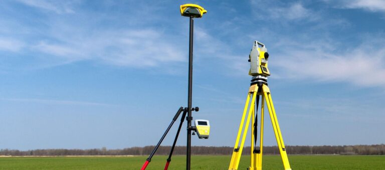
An RTK GNSS receiver for drones, by contrast, uses a base station or network correction service to eliminate satellite signal errors caused by ionospheric delay, orbital drift, and clock timing. The result is position accuracy of 1–2 cm—a 100–500x improvement over standard GPS.
| Feature | Standard GPS Drone | RTK GNSS Drone |
|---|---|---|
| Accuracy | 2–5 metres | 1–2 centimetres |
| Constellations | GPS (L1 only) | GPS + GLONASS + Galileo + BeiDou (L1/L2/L5) |
| Correction method | None | RTK base / NTRIP network |
| Best for | Recreation, basic waypoints | Survey, mapping, inspection, precision agriculture |
| Post-processing needed | No (inaccurate anyway) | Optional (PPK backup) |
When Do Drones Actually Need RTK?
RTK GNSS becomes essential—not optional—in these scenarios:
- Survey-grade mapping: Generating orthomosaic maps, DSM/DTM, or contour lines requires centimetre accuracy. Without RTK, you spend hours placing ground control points (GCPs) to correct the drone’s drift. With RTK, GCPs are often unnecessary.
- Construction site monitoring: Measuring stockpile volumes, tracking earthworks progress, or inspecting structures needs repeatable sub-5 cm accuracy flight after flight.
- Precision agriculture: Variable-rate application, crop scouting, and yield mapping depend on knowing exactly where the drone is relative to the field.
- Linear infrastructure inspection: Inspecting power lines, pipelines, or railway corridors requires the drone to maintain a precise standoff distance from the asset—standard GPS drift creates collision risk.
- Autonomous navigation: Drones operating in GNSS-denied or GPS-spoofed environments need the most reliable position data available. Combined with anti-jamming technology, RTK GNSS provides the resilience professional operations demand.
What to Look for in a Drone RTK GNSS Receiver
Not all drone GNSS receivers are equal. Here are the key specs to evaluate:
- Multi-frequency, multi-constellation support: A receiver that tracks L1, L2, and L5 signals across GPS, GLONASS, Galileo, and BeiDou provides faster RTK fix acquisition and better performance under tree canopy or in urban canyons.
- Anti-jamming and anti-spoofing protection: UAV operations increasingly face RF interference—whether accidental (radio towers, power lines) or intentional (GPS jammers). Receivers with AIM+ anti-jamming technology maintain lock in environments where standard receivers lose position entirely.
- Size, weight, and power (SWaP): For drone integration, the receiver module must be compact and lightweight. OEM boards like the mosaic-X5 and mosaic-G5 P3H weigh under 20 g and consume minimal power, making them ideal for UAV payloads.
- Autopilot compatibility: Your GNSS receiver must integrate cleanly with Pixhawk, ArduPilot, or PX4 flight controllers. Look for receivers that output standard UBX or NMEA sentences at configurable rates (up to 100 Hz).
- PPK fallback: Some operators prefer post-processing kinematic (PPK) as a belt-and-suspenders approach. A receiver that supports both RTK and raw RINEX logging gives you flexibility.
RTK vs PPK: Which Is Right for Your Drone?
RTK gives you real-time centimetre accuracy during the flight, which means you can verify data quality immediately. PPK processes the same corrections after the flight, which is useful when real-time correction links are unreliable.
Many professional UAV operators choose a hybrid approach: fly with RTK for real-time positioning confidence, and log raw data for PPK as a backup. The best GNSS receivers for drones support both modes without compromise.
Industries Where RTK Drone GNSS Is Becoming Standard
- Surveying and Mapping: Surveyors now routinely deploy RTK-equipped drones to capture topographic data faster and safer than ground crews.
- Construction and Mining: Drone-based volume calculations, progress tracking, and site surveys rely on repeatable sub-5 cm accuracy across multiple flights.
- Agriculture: Precision farm operators use RTK drones for field scouting, NDVI analysis, and variable-rate application mapping.
- Infrastructure Inspection: Power utilities, oil and gas operators, and rail networks use RTK drones for asset inspection, reducing human risk and downtime.
- Environmental Monitoring: Coastal erosion tracking, forestry surveys, and landfill monitoring all benefit from the positional certainty RTK provides.
For more details on how RTK GNSS receivers integrate with specific drone platforms, see our UAV and Drone GNSS RTK solutions page.
Frequently Asked Questions
If you’re evaluating RTK GNSS receivers for your drone platform, contact our team to discuss your specific integration requirements.