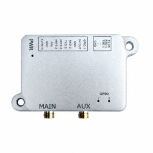
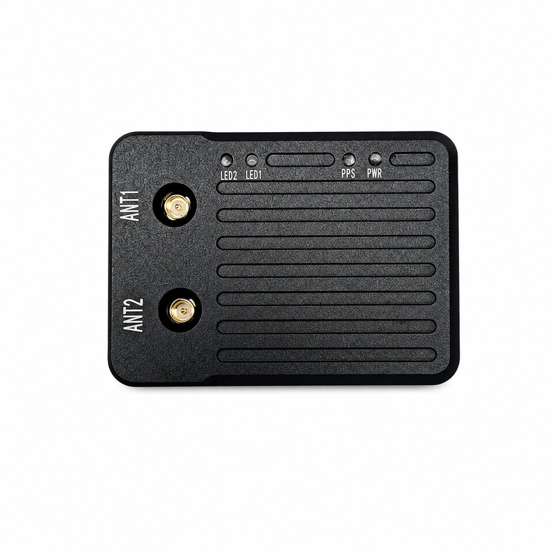
HB52H / HB52 Ultralight RTK GNSS Receiver — Septentrio mosaic-G5
Ultralight RTK GNSS receiver for drones, robots and precision control
- Septentrio mosaic-G5, all-constellation, all-frequency
- Centimetre-level RTK: 0.6 cm + 0.5 ppm, 7 s initialization
- HB52H: dual-antenna heading 0.15° (1 m baseline)
- 20 Hz output with <10 ms latency
- AIM+ anti-jamming and Galileo OSNMA anti-spoofing
- USB Type-C and microSD logging (up to 32 GB)
- Small size: 48 × 35 × 12.6 mm
No forms to fill in — we reply within one business day.
Ultralight RTK GNSS receiver with optional dual-antenna heading
The Eview HB52 is an ultralight, all-constellation, all-frequency RTK GNSS receiver built around the Septentrio mosaic-G5. It gives centimetre-level position with low, predictable latency for UAVs, autonomous robots and precision control. The HB52H version adds a second antenna input for heading and pitch or roll; the HB52 is the single-antenna positioning version. Both are part of our mosaic-G5 box receivers.
Single or dual antenna
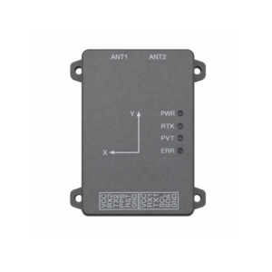
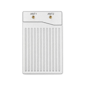
Connect one antenna for RTK positioning, or two antennas on the HB52H for true heading without vehicle motion: 0.15° heading and 0.25° pitch/roll with a 1 m baseline, and 0.03° / 0.05° with 5 m. See how dual-antenna GNSS heading works.
AIM+ anti-jamming and OSNMA anti-spoofing
Septentrio AIM+ shows an interference indicator and spectrum view, and suppresses narrowband and wideband interference so the HB52 keeps its fix near radio links, motors and other noisy electronics. Galileo OSNMA authenticates satellite signals to protect against spoofing. Learn more about anti-jamming GNSS receivers and OSNMA anti-spoofing.
GNSS+ technologies
LOCK+ keeps tracking stable under vibration and fast movement. IONO+ protects RTK accuracy during ionospheric scintillation (why RTK drops after sunset). APME+ reduces multipath near buildings and metal structures. RAIM+ monitors position integrity.
Easy integration and logging
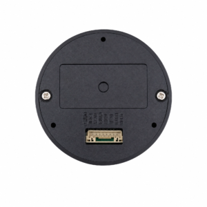
A GH1.25 8-pin connector carries power, two UARTs and I2C for flight controllers and robot computers, and USB Type-C gives a direct link to a PC for setup and data. The HB52 accepts RTCM v3.x corrections (including MSM) from CORS networks or your own base, outputs NMEA 0183 and Septentrio SBF, and logs complete raw measurements to a microSD card of up to 32 GB for post-processing. It works with popular open-source autopilots. Firmware and manuals are on our firmware downloads page.
Applications
- UAVs and drones: light RTK position and heading for mapping, survey and industrial drones.
- Smart robots and AGVs: centimetre positioning and heading for outdoor autonomous robots.
- Precision agriculture: guidance and auto-steering for tractors and field robots.
- Surveying and GIS: compact rover or base station with raw data logging.
- Hazard and deformation monitoring: continuous precise positioning for landslide and structural monitoring.
- Vehicles and logistics: lane-level positioning and heading for vehicles and intelligent logistics.
Frequently asked questions
What is the difference between the HB52 and the HB52H?
Both use the Septentrio mosaic-G5 and give the same RTK accuracy. The HB52H accepts two antennas for heading and pitch or roll (0.15° heading at 1 m baseline); the HB52 is the single-antenna positioning version.
Does the HB52 work with ArduPilot and PX4?
Yes. The HB52 connects over UART and outputs standard NMEA and Septentrio SBF, which popular open-source autopilots support. See our ArduPilot GNSS guide.
Can the HB52 log raw data for post-processing?
Yes. It records complete raw measurements to a microSD card of up to 32 GB. Septentrio SBF files can be converted to RINEX for PPK and other post-processing software.
How does the HB52 compare with the HB51?
Both use the mosaic-G5. The HB52 is smaller and lighter, with USB Type-C and microSD logging. The HB51 adds a built-in RM3100 magnetometer for compass heading.
How do I get the full HB52 datasheet or a quote?
Email sales@gnss-solutions.com for the complete datasheet, or ask a quote with your application and quantity.
Related reading
HB52H specifications
| GNSS engine | Septentrio mosaic-G5, 789 hardware channels |
|---|---|
| Versions | HB52H: dual antenna, positioning + heading · HB52: single antenna, positioning |
| GNSS signals | GPS L1C/A, L1C, L2C, L2P(Y), L5 · GLONASS L1, L2, L3 CDMA · Galileo E1, E5a, E5b, E6 · BeiDou B1I, B1C, B2a, B2I, B2b, B3I · QZSS L1C/A, L1C/B, L2C, L5, L6 · NavIC · SBAS |
| RTK accuracy (RMS) | 0.6 cm + 0.5 ppm horizontal, 1 cm + 1 ppm vertical |
| Standalone / DGNSS accuracy | 1.2 m / 0.4 m horizontal; 1.9 m / 0.7 m vertical |
| RTK initialization | 7 s |
| Heading / pitch-roll accuracy (HB52H) | 0.15° / 0.25° (1 m baseline); 0.03° / 0.05° (5 m baseline) |
| Velocity accuracy | 0.03 m/s |
| Maximum update rate | 20 Hz |
| Latency | <10 ms (99.9%) |
| Time to first fix | Cold <35 s, warm <10 s, reacquisition 1 s |
| Timing accuracy | xPPS 1.4 ns, event <3 ns |
| Data formats | RTCM v3.x (incl. MSM) input, NMEA 0183, Septentrio SBF |
| Interfaces | 2 × UART + I2C (GH1.25 8-pin), USB Type-C, microSD up to 32 GB, 2 × MMCX antenna |
| Antenna LNA gain / bias | 15–50 dB single, 15–35 dB dual; 3.0–5.5 V, 150 mA limit |
| Operating temperature | -40 °C to +85 °C |
| Dimensions | 48 × 35 × 12.6 mm |
| Complete datasheet | On request: sales@gnss-solutions.com |
Product datasheet
The complete datasheet (GNSS signals, interfaces, pin-out, electrical and environmental specifications) is available on request. Email sales@gnss-solutions.com with the product name and your application.
Support documentation
Ask a quote or contact our engineers for integration support.